7km return | 4-6 hour return | Fiordland
For experienced hikers familiar with alpine conditions, this is a must do hike in Fiordland. If you only have half a day free on your way to Milford Sound, then prioritise this walk - the scenery is phenomenal! For an extra special experience, camping here is something I really recommend. I had been trying to do this for a number of years but never had the weather window, so when I finally got the opportunity, I didn’t hesitate, and it was as good (if not better) than what I could imagine.
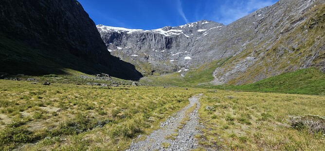
The walk starts from a gravel car park at the side of the Milford Road and is well formed and for the most part well signposted. Initially you follow along a stream bed along a clearly marked path, crossing over the riverbed (no water) and then continuing on into a short section of bush.
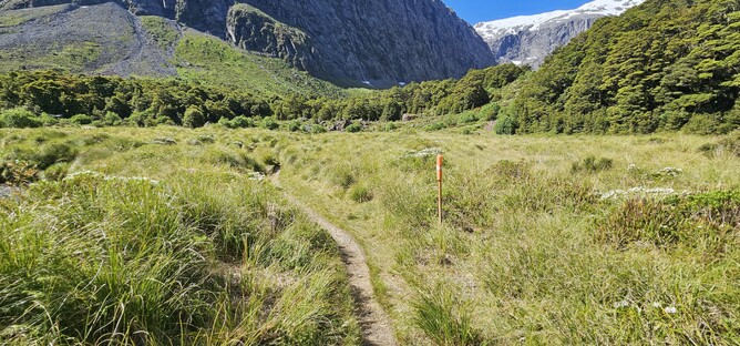
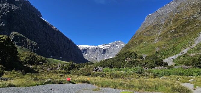
Popping out of the bush you find yourself in a beautiful valley that makes you feel tiny. The path used to be really well defined and easy to follow when I had been previously, but on this occasion, it was a little more tricky to pick my way along the rock fall and towards the end of the valley. It is easy enough if you know where you are headed, but certainly worth ensuring you keep searching for orange markers if unfamiliar with the area.
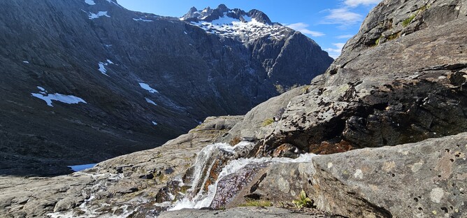
After around 30 minutes of walking, we arrived at the start of the first little ascent, up the hill to the left in the picture below, following marker poles towards the waterfall. This is the first major point of reference in terms of why this track is considered an advanced track – there have been a few people that have unfortunately missed the turning to cross back over the waterfall on their return journey and this has resulted in fatalities, so it is really important to ensure you have good route finding skills and know how to get back to this point. After crossing the waterfall, you are following a mixture of cairns and orange markers up towards the saddle so it is worth taking time to make sure you check you are on the right track.
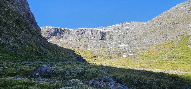
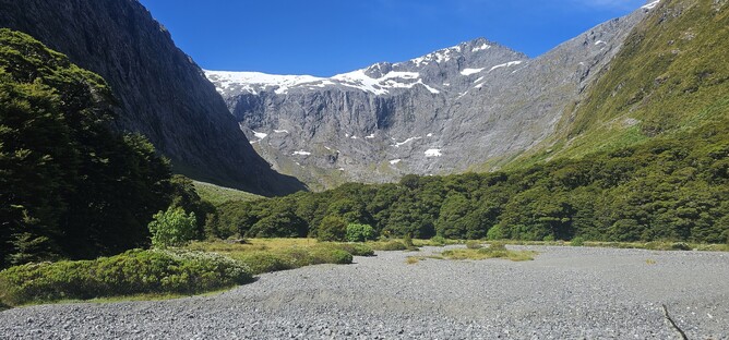
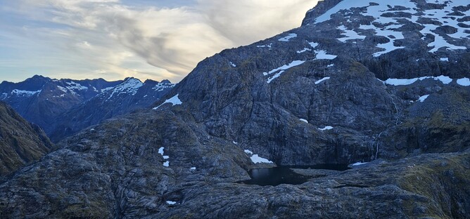
On this visit, there was still the remnants of snow from the winter lying on the side of the track below the waterfall that tumbles out from the lake above. You stay to the right of the Getrude stream, always looking out for markers up ahead. Eventually moving from the stony path across onto the big grey slabs of rock that you will recognise from any pictures taken of this route.
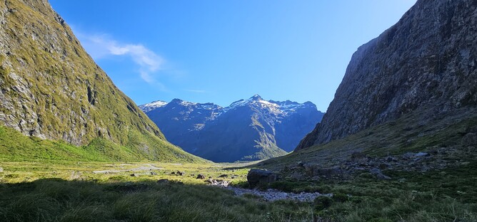
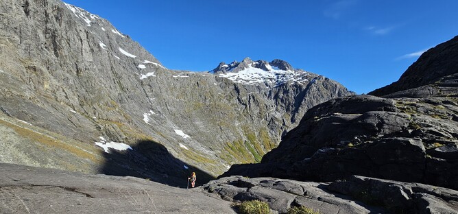
Above: The view back along the valley you have just walked through.
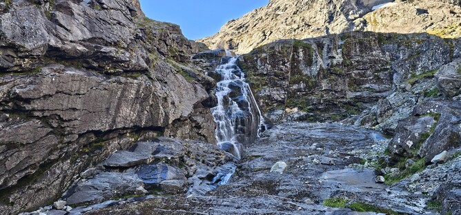
Around 30 minutes after crossing the stream at the waterfall we arrived at the climb up to the lake. There are chains in place to assist, which are great in giving direction. On the way up you generally don’t need them, but they certainly give confidence on the way down. This is a section you wouldn’t want to do in wet conditions as the rock becomes very slippery, so good weather is essential for doing this track. If considering an overnight stay, make sure you check the next day’s forecast, as coming down will be worse than going up. In dry conditions, the climb up from here isn’t too challenging but the terrain is stunning.
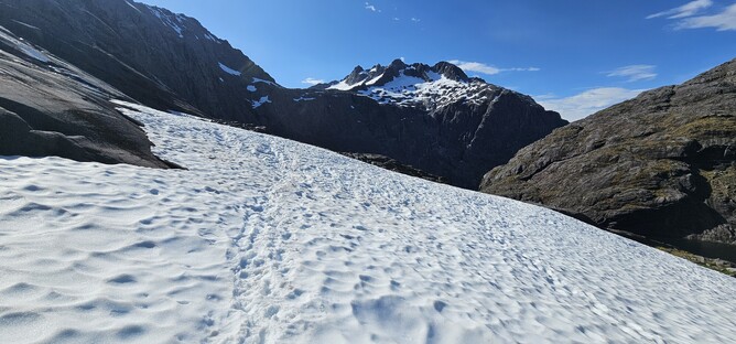
A final section of boulder hopping leads the way up to the saddle. There are several different routes through here and it really depends on your personal preference as to the terrain you prefer as to which way you go. This time there was a big section of snow with a well-worn path through it, so I followed this for a small section before heading to the bigger boulders.
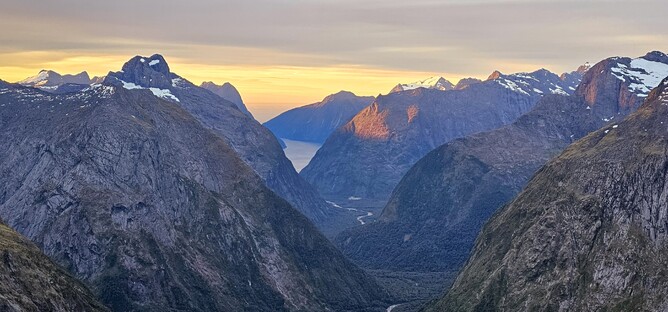
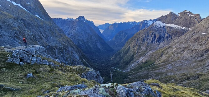
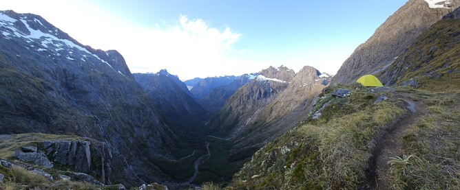
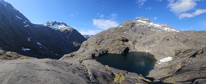
Within around 20 minutes I reached the saddle and the view when you take the final few steps is breathtaking. A steep vertical drop down into an impressive, green lined valley that looks out to Milford Sound greets you, and no matter how many times you have been and how much you think you know what to expect – it is always spectacular.
From the saddle, you can continue on up the hill towards the right towards Barrier Knob. This is actually where I thought I would be camping, but as we arrived pretty late in the day we missed out on that spot and so ended up camping right on the saddle which was also great. A little rock wren greeted us as we set up the tent and as the sun began to set we made our way up the hill to get some views from a higher point. There were a surprising number of people camping up there, which I hadn’t expected. Good sites available at the sadlle, up towards Barrier Knob and also across to the left of the saddle on the edge of the lake.
If you find yourself in Fiordland with good weather forecast for a couple of days, this would be my number one pick for an overnight with incredible views. As it is also pretty short (one way) you can do it after visiting one of the other walks on the Milford Road and leaving early in the morning on departure day would get you down with almost a whole day to play with, so it is well worth doing. However, remember that the rock gets slippery, so any risk of ice or wet conditions make this one to avoid, as well as poor visibility which would make it really challenging to navigate.
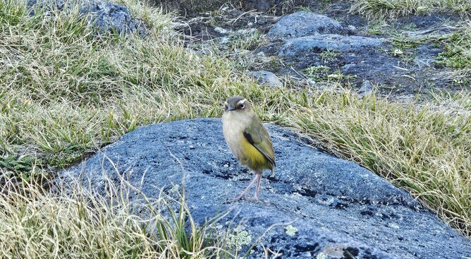
Above: The friendly Rock Wren that kept us company whilst setting up the tent.
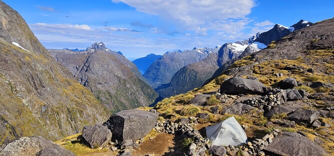
Above: Tents set up near the lake to the left of the saddle.
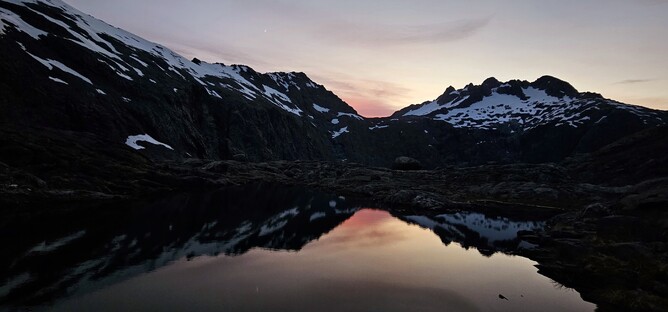
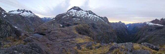
Above: The lake that people were camping next to at sunrise.
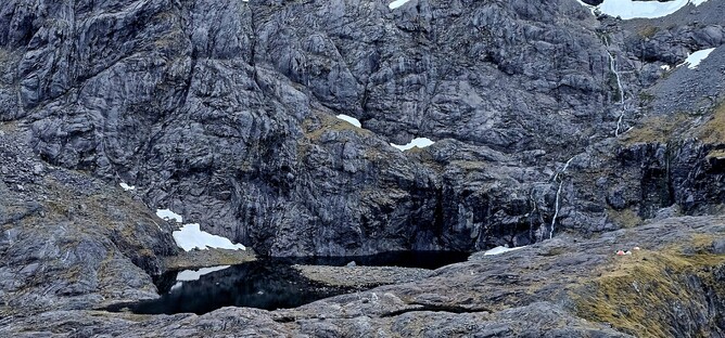
Below: A view of Black Lake on our descent back down.
Parking: There is a car park directly off the Milford Road. This is signposted and follows a gravel road for a short section.
Accommodation: Camping. Pack in, Pack out.