4 hrs to Summit | 10.9km one way | West Coast (Hokitika)
There is something so special about the West Coast of New Zealand's South Island. If you get a good day, it has it all - views of snow capped mountains, the ocean, braided rivers, beautiful beaches and incredibly lush native bush. The fact that so often this remains hidden under the cloud and rain makes it all the more special when you do get one of those good days and is something to savour! On my last visit to the region I struck gold with three amazing nights and so I made the most of my time with three nights spent in the mountains.
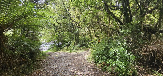
The track to the Mount Brown Summit (via Mount Brown Hut) starts in a small wooded area off the road. There used not to be a sign post here, but now there is a sign on the road marking the car park which gives you a bit more confidence that you are in the right place! Following the markers through the bush you head out towards the river initially before turning back into the bush.
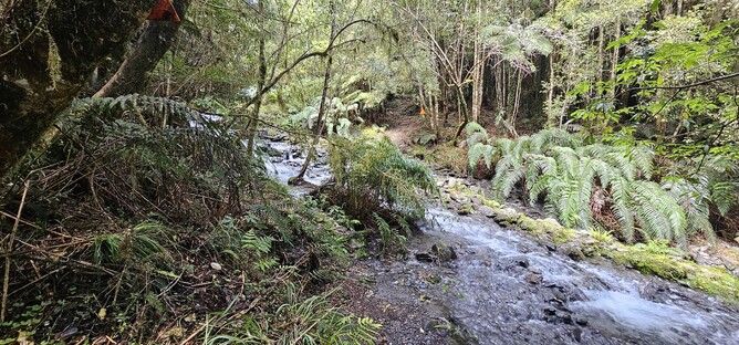
The amount of rain in the region means that this track is often muddy, but it also means the bush is incredible and it is a really nice start to the track picking your way carefully through to the stream crossing. I have been here after heavy rain and on a reasonably good day and I can't say I particularly remembered the stream crossing on either occasion, which suggests it was never particularly challenging. The two days prior to me doing the track on this occasion were quite rainy, yet there wasn't too much to negotiate. The picture below gives you a good idea of the level of the water.
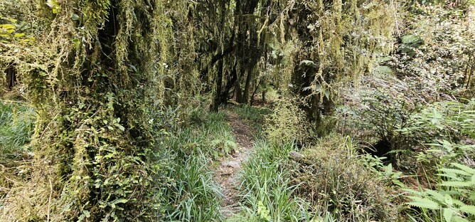
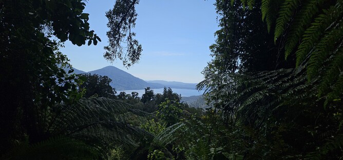
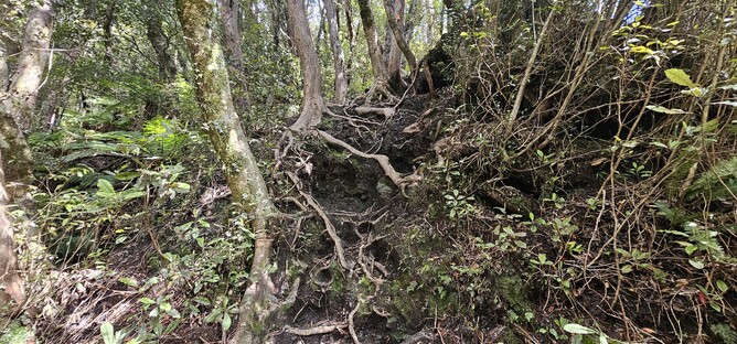
Following the stream crossing you continue on through the bush. The track is well marked, but at times it can be easy to miss a marker, so if you haven't seen one in a while it is worth tracking back a little to ensure you haven't followed an animal path by mistake. From here the route starts getting steadily steeper and you will find yourself scrambling up tree roots and around rocky boulders. There is the occasional gap in the trees for you to enjoy a bit of a view back out across Lake Kaniere and catch your breath.
The steeper section continues for approximately one hour - with a heavy overnight bag it is far less fun than with a nice light day pack. Given that you are constantly ducking under trees or scrambling up rocks you certainly do notice the difference.
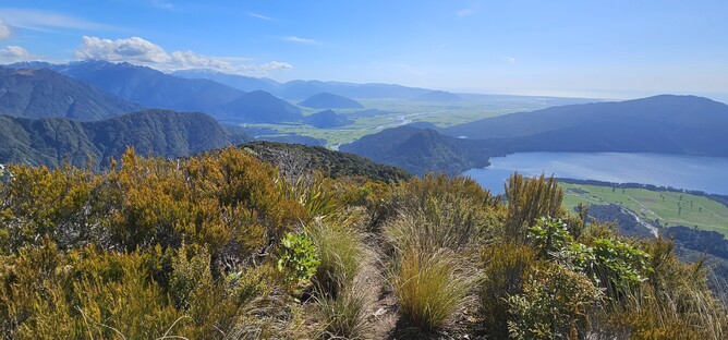
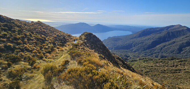
As you approach the top of the tree line, the muddiness increases, just to challenge the motivation a little more! However, once you pop up out of the trees, the views make you forget the hard slog and you can just enjoy being in one of the most stunning places imaginable. Lake Kaniere forms a bit of a focus point for your attention, however soon the detail in the full picture emerges which is even more prominent up higher - braided river, coast line, lake and bush in one direction and then snow capped mountains in the other. Certainly worth taking a minute to enjoy before embarking on the final 30 minutes to the Hut.
From the tree line the track changes to tussocks and finally a rock lined path that weaves its way up the final part of the climb to the Hut. Fortunately for your now weary legs you don't need to go all the way up the hill you see in front of you and instead you swing round the back of the hill which then reveals first dight of the beautiful little orange hut for the first time.
This is a four bunk hut that is not part of the DOC network and cannot be booked, so it is first come, first served. Unfortunately, it seems that many people decide not to fill out the visitors book (important for both safety and monitoring) and do not pay for use of the hut, which is a real shame given that this hut was moved here and is maintained by a volunteer group.
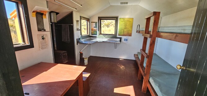
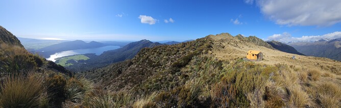
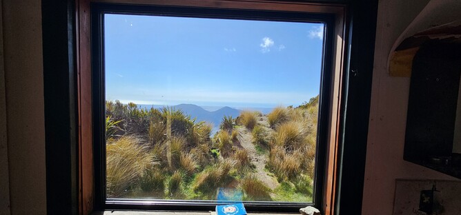
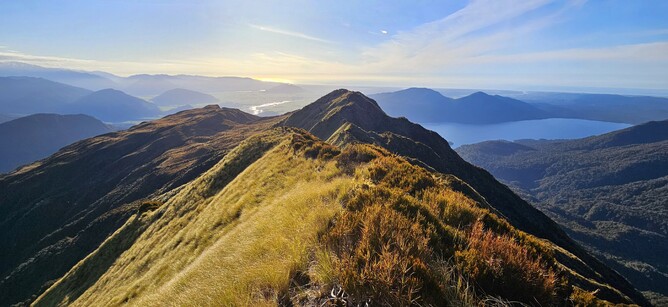
The hut is sat beautifully perched on a ridge with the Lake below and mountains all around. It really is perfectly nestled into the mountain and provides a great base for further exploration! After I had reserved myself a bed and lightened my bag somewhat, I departed the hut and started the next phase of the walk up towards the summit. From the hut I turned right and followed the ridgeline up in the direction of the summit.
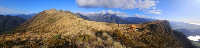
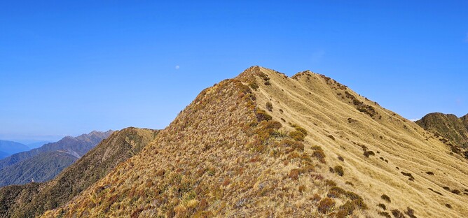
The track to the summit isn't marked, but there is a fairly well worn track from where others have walked. It more or less follows the ridge with a few exceptions where it drops below to navigate around some bumps.
After about 10 minutes you drop down over the first little bump before the climbing starts. It opens up a much wider view of the lake and rivers below.
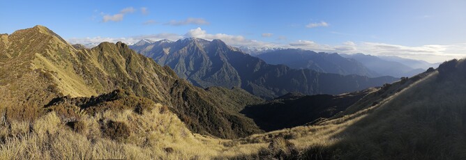
Whilst there are a few steeper sections, it isn't a tough climb and the panoramic views distract you from the physical effort. As I started the final steeper climb towards the summit I was lucky enough to get a fly past from one of the local Kea who decided to give me a bit of an aerial show under the moon. One of my absolute favourite birds, so just about made my day seeing one here.
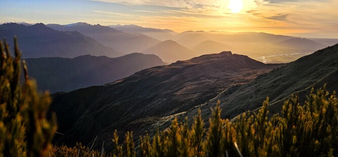
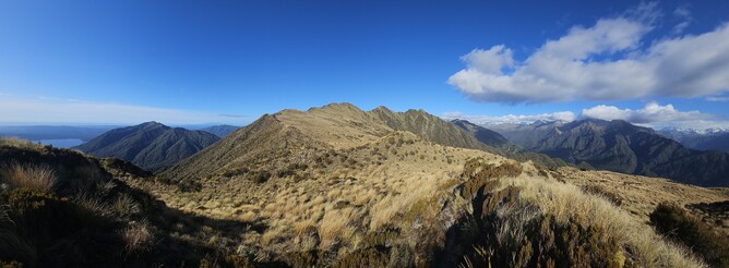
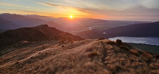
One hour after leaving the hut I made it to the summit. Views in all directions and luckily for me what turned out to be a stunning sunset. I stayed up at the top for around an hour as the sunset began, before making my way slowly back to the hut, enjoying the incredible light as it set across the West Coast landscape below.
Parking: It is possible to park at the start of the track off the road, signposted from the road.
Overnight Options: Mount Brown Hut is maintained by the Permolat Trust and can be paid for via their website. It is a four bunk hut and is not bookable. You can search for bank details via the Remote Huts website.